Main Content

Scenario Generation and Visualization

Simulation, analysis, and visualization of satellites in orbit

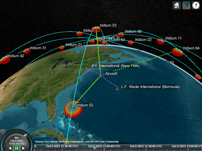
Generate satellite scenarios to model and visualize satellites in orbit and to perform additional analyses such as computing access with ground stations.

Objects

satelliteScenarioSatellite scenario (Since R2021a)
satelliteScenarioViewerCreate viewer for satellite scenario (Since R2021a)
SatelliteSatellite in satellite scenario (Since R2021a)
PlatformPlatform in satellite scenario (Since R2024a)
GroundStationGround station object belonging to satellite scenario (Since R2021a)
ConicalSensorConical sensor object belonging to satellite scenario (Since R2021a)
GroundTrackGround track object belonging to satellite or platform in scenario (Since R2021a)
TransmitterTransmitter object belonging to satellite scenario (Since R2021a)
ReceiverReceiver object belonging to satellite scenario (Since R2021a)
PatternRadiation pattern visualization (Since R2021b)
GimbalGimbal object belonging to satellite scenario (Since R2021a)
AccessAccess analysis object belonging to scenario (Since R2021a)
FieldOfViewField of view object belonging to satellite scenario (Since R2021a)
LinkLink analysis object belonging to Transmitter (Since R2021a)
OrbitOrbit visualization satellite object (Since R2024a)
geoTrajectoryWaypoint trajectory in geodetic coordinates (Since R2024a)
quaternionCreate quaternion array

Functions

expand all

aerCalculate azimuth angle, elevation angle, and range of another satellite or ground station in NED frame (Since R2021a)
advanceMove simulation forward by one sample time (Since R2022a)
dopplershiftCalculate Doppler shift at target asset in satellite scenario (Since R2023a)
hideHide satellite scenario entity from viewer (Since R2021a)
latencyCalculate propagation delay from one asset to another asset (Since R2023a)
orbitalElementsOrbital elements of satellites in scenario (Since R2021a)
playPlay satellite scenario simulation results on viewer (Since R2021a)
restartRestart simulation from beginning (Since R2022a)
showShow object in satellite scenario viewer (Since R2021a)
skyplotPlot satellite azimuth and elevation data (Since R2021a)
statesObtain position and velocity of satellite or platform (Since R2021a)
campitchSet or get pitch angle of camera for Satellite Scenario Viewer (Since R2021a)
camrollSet or get roll angle of camera for Satellite Scenario Viewer (Since R2021a)
camposSet or get position of camera for Satellite Scenario Viewer (Since R2021a)
camheadingSet or get heading angle of camera for Satellite Scenario Viewer (Since R2021a)
camheightSet or get height of camera for Satellite Scenario Viewer (Since R2021a)
camtargetSet camera target for Satellite Scenario Viewer (Since R2021a)
hideAllHide all graphics in satellite scenario viewer (Since R2021a)
showAllShow all graphics in viewer (Since R2021a)
accessPercentagePercentage of time when access exists between first and last node in access analysis (Since R2021a)
accessIntervalsIntervals during which access status is true (Since R2021a)
accessStatusStatus of access between first and last node defining access analysis (Since R2021a)
gaussianAntennaAdd Gaussian antennas (Since R2021a)
ebnoEb/No at final node of link (Since R2021a)
linkPercentagePercentage of time when link between first and last node in link analysis is closed (Since R2021a)
linkStatusStatus of link closure between first and last node (Since R2021a)
linkIntervalsIntervals during which link is closed (Since R2021a)
sigstrengthCalculate received signal strength at last node of link (Since R2022b)
gimbalAnglesSteering angles of gimbal (Since R2021a)
pointAtPoint satellite at target (Since R2021a)

Topics

Featured Examples

Go to top of page