altitudeEnvelopeContour
Syntax
Description
Draw Contour Plots with Load Factors and Meshes
altitudeEnvelopeContour( draws a
contour plot of the loadfactor)loadfactor matrix in the
x-y plane. This function is based on the
MATLAB®
contour function. The
x-coordinates of the vertices correspond to the column indices of
loadfactor and the y-coordinates correspond to
the row indices of loadfactor. The contour automatically chooses the
contour levels.
altitudeEnvelopeContour(
draws a contour plot of the airspeed,altitude,loadfactor)loadfactor matrix using vertices from
the mesh that airspeed and altitude define.
Draw Contour Plots with Customizations
altitudeEnvelopeContour(___,
plots an altitude envelope contour specified by the desired levels
levels)levels.
altitudeEnvelopeContour(___,
plots an altitude envelope contour specified by the desired line spec
LineSpec)LineSpec.
altitudeEnvelopeContour(___,
plots an altitude envelope contour specified by one or more
Name,Value)Name,Value arguments.
altitudeEnvelopeContour(
draws an altitude contour plot onto the axes ax.ax,___)
Return Matrix, Contour Object, and Boundary Line Object
[
returns contour matrix c,h,bline] = altitudeEnvelopeContour(___)c, a contour object h,
and a vector of boundaryline objects b. To label
the plot, use the c and bs arguments as inputs
to the clabel function when using the
LabelSpacing property.
Tip
For more information on the contour matrix, see the Contour Properties property for contour objects.
Examples
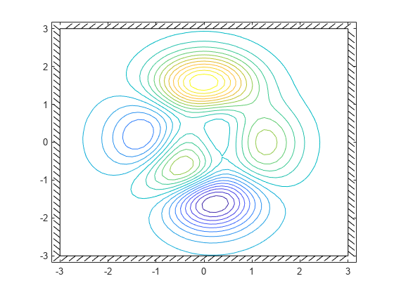
Plot an altitude envelope contour with default levels and boundaries.
[speed,alt,loadfactor] = peaks();
altitudeEnvelopeContour(speed,alt,loadfactor)

Plot an altitude envelope contour with 20 levels and default boundaries.
[speed,alt,loadfactor] = peaks();
altitudeEnvelopeContour(speed,alt,loadfactor,20)
Plot an altitude envelope contour with constant boundary lines, and turn off boundary line intersection clipping.
[speed,alt,loadfactor] = peaks();
altitudeEnvelopeContour(speed,alt,loadfactor,...
"MinimumSpeed",0,"MaximumAltitude",2,"ResolveBoundary","off")

Plot an altitude envelope contour with custom boundary data. Return line objects and boundary line objects in c, h, and b.
x = linspace(-15,15);
y = linspace(-15,15);
[X,Y] = meshgrid(x,y);
Z = sin(X)+cos(Y);
t = linspace(2*pi,0);
boundaryX = 16*sin(t).^3;
boundaryY = 13*cos(t) - 5*cos(2*t) - 2*cos(3*t) - cos(4*t);
[c,h,b]=altitudeEnvelopeContour(X,Y,Z,...
"BoundaryXData",boundaryX,"BoundaryYData",boundaryY);

Input Arguments
Load Factor for each airspeed and altitude, specified as a numeric matrix typically in g's.
Data Types: double
Aircraft airspeed for each corresponding index in loadfactor,
specified as a numeric vector or matrix.
Data Types: double
Aircraft altitude for each corresponding index in loadfactor,
specified as a numeric vector or matrix.
Data Types: double
Levels for which to develop contour lines, specified as a scalar or vector.
If
levelsis a scalar,levelsspecifies the number of contour lines, and the contour levels are chosen automatically bycontour.If
levelsis a vector,levelsspecifies the number and levels of contour lines to plot.
Tip
To draw the contours at one height (k), specify levels as a
two-element row vector [k
k].
Example: [2 3]
Data Types: double
Line style, marker, and color, specified as a string scalar or character vector containing symbols. The symbols can appear in any order. You do not need to specify all three characteristics (line style, marker, and color). For example, if you omit the line style and specify the marker, then the plot shows only the marker and no line.
Example: "--or" is a red dashed line with circle markers.
| Line Style | Description | Resulting Line |
|---|---|---|
"-" | Solid line |
|
"--" | Dashed line |
|
":" | Dotted line |
|
"-." | Dash-dotted line |
|
| Marker | Description | Resulting Marker |
|---|---|---|
"o" | Circle |
|
"+" | Plus sign |
|
"*" | Asterisk |
|
"." | Point |
|
"x" | Cross |
|
"_" | Horizontal line |
|
"|" | Vertical line |
|
"square" | Square |
|
"diamond" | Diamond |
|
"^" | Upward-pointing triangle |
|
"v" | Downward-pointing triangle |
|
">" | Right-pointing triangle |
|
"<" | Left-pointing triangle |
|
"pentagram" | Pentagram |
|
"hexagram" | Hexagram |
|
| Color Name | Short Name | RGB Triplet | Appearance |
|---|---|---|---|
"red" | "r" | [1 0 0] |
|
"green" | "g" | [0 1 0] |
|
"blue" | "b" | [0 0 1] |
|
"cyan"
| "c" | [0 1 1] |
|
"magenta" | "m" | [1 0 1] |
|
"yellow" | "y" | [1 1 0] |
|
"black" | "k" | [0 0 0] |
|
"white" | "w" | [1 1 1] |
|
Valid axes, specified as a scalar handle. By default, this function plots to the current axes,
obtainable with the gca function.
Data Types: double
Name-Value Arguments
Output Arguments
More About
Version History
Introduced in R2021b