gradientm
Gradient, slope, and aspect of data grid
Syntax
Description
Regular Data Grids
[
returns the aspect angle, slope angle, and north and east components of the gradient for
the regular data grid aspect,slope,gradN,gradE] = gradientm(F,R)F with raster reference R.
By default, gradientm locates the latitude and longitude coordinates
referenced by R using the spheroid contained in the
Spheroid property of the geocrs object in the
GeographicCRS property of R. If the
GeographicCRS property of R is empty, then
geopeaks uses GRS80.
Geolocated Data Grids
Examples
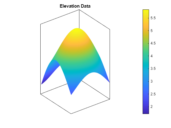
Generate sample elevation data for the region around a mountain summit using a geographic postings reference object and the geopeaks function. To do this, first create a reference object for the region by specifying the latitude and longitude limits and the size of the elevation data grid. Next, generate elevation data for the region using geopeaks.
latlim = [10 45];
lonlim = [60 100];
size = [100 100];
R = georefpostings(latlim,lonlim,size);
F = geopeaks(R);
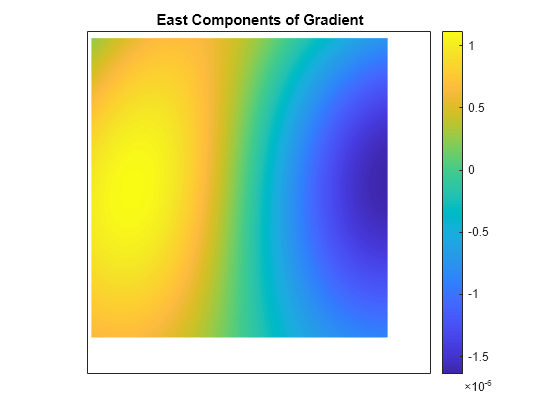
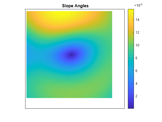
Compute the aspect angles, slope angles, and gradient components of the data.
[aspect,slope,gradN,gradE] = gradientm(F,R);
Visualize the results by plotting the data. Create a map using an equidistant cylindrical projection and plot the data as a surface. Adjust the aspect ratio of the map by using the daspect function. View the map in 3-D by using the view function.
figure
axesm("eqdcylin")
geoshow(F,R,DisplayType="surface")
daspect([1 1 5])
title("Elevation Data")
colorbar
view(3)
Then, plot the gradient components using the same projection. Note that both the north and east component values are zero at the summit.
figure
axesm("eqdcylin")
geoshow(gradN,R,DisplayType="surface")
title("North Components of Gradient")
colorbar
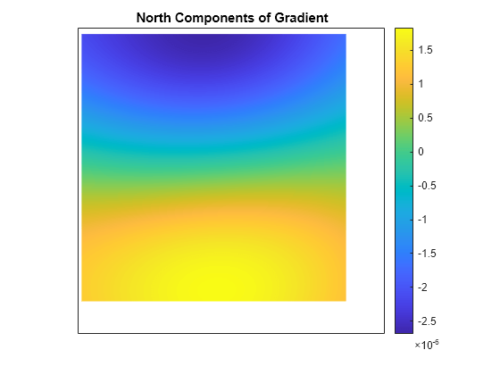
figure
axesm("eqdcylin")
geoshow(gradE,R,DisplayType="surface")
title("East Components of Gradient")
colorbar
Plot the slope angles. Note that the value of the slope angle is zero at the summit.
figure
axesm("eqdcylin")
geoshow(slope,R,DisplayType="surface")
title("Slope Angles")
colorbar
Plot the aspect angles. An aspect angle describes the direction the mountain slope faces as an azimuth measured clockwise from north.
figure
axesm("eqdcylin")
geoshow(aspect,R,DisplayType="surface")
title("Aspect Angles")
colorbar
