Main Content

location

Coordinates at distance and angle from site

Since R2019b

Description

sitelocation = location(site) returns the site location of the antenna.

example

[lat,lon] = location(site) returns the latitude and longitude of the antenna site.

This syntax only supports antenna sites with a CoordinateSystem property value of 'geographic'.

[___] = location(site,distance,azimuth) returns the new location achieved by moving the antenna site by the distance specified in the direction of the azimuth angle. The location is calculated by moving along a great circle path using a spherical Earth model.

This syntax only supports antenna sites with a CoordinateSystem property value of 'geographic'.

Examples

collapse all

Create a site 1 km north of a given site.

Create the first transmitter site.

tx = txsite(Name="MathWorks",Latitude=42.3001,Longitude=-71.3504);

Calculate the location 1 km north of the first site.

[lat,lon] = location(tx,1000,90)
lat = 42.3091
lon = -71.3504

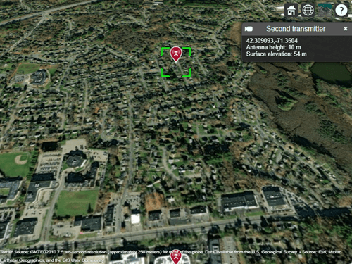
Create a second transmitter site at the location specified by lat and lon.

tx2 = txsite(Name="Second transmitter",Latitude=lat,Longitude=lon);

Show the two transmitter sites.

show([tx tx2])

Two transmitter sites displayed over a satellite basemap. An information box shows the coordinates, antenna height, and surface elevation for the second transmitter.

Input Arguments

collapse all

Antenna site, specified as a scalar or an array. It is either a txsite or a rxsite object. For more information, see txsite, and rxsite

Note

If distance or azimuth is a vector, then site must be a scalar.

Distance to move antenna site, specified as a scalar or vector in meters.

Azimuth angle, specified as a scalar or vector in degrees. Azimuth angle is measured counterclockwise from due east.

Output Arguments

collapse all

Location of antenna site, returned as an M-by-2 matrix with each element unit in degrees. M is the number of sites in sites. The location value includes the latitude and longitude of the antenna site.

If the antenna site has the CoordinateSystem property set to 'geographic', L is a 1-by-2 vector in degrees latitude and longitude. The output longitude wrapped so that values are in the range [-180 180]. If SITE has CoordinateSystem set to 'cartesian', L is a 1-by-3 vector.

Latitude of one or more antenna sites, returned as an M-by-1 vector with each element unit in degrees. M is the number of sites in site.

Longitude of one or more antenna sites, returned as an M-by-1 matrix with each element unit in degrees. M is the number of sites in site. The output is wrapped so that the values are in the range [-180 180].

Version History

Introduced in R2019b

See Also

| | |