addCustomTerrain
Add custom terrain data
Description
addCustomTerrain(
adds the terrain data specified with a user-defined terrainName,files)terrainName
and files. You can use this function to add custom terrain data
in Site Viewer and other RF propagation functions. You can access the custom terrain
data in the current and future sessions of MATLAB® until you call removeCustomTerrain.
Note
In Antenna Toolbox™, addCustomTerrain function converts terrain
elevation data from orthometric to ellipsoidal for visualization and when
performing Euclidean distance or angle calculations between locations for
example for free space path loss.
addCustomTerrain(___,
adds custom terrain data with additional options specified by one or more name-value
pairs.Name,Value)
Examples
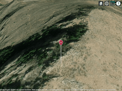
Add terrain for a region around Boulder, CO. The DTED file was downloaded from the "SRTM Void Filled" data set available from the U.S. Geological Survey.
dtedfile = "n39_w106_3arc_v2.dt1";
attribution = "SRTM 3 arc-second resolution. Data available from the U.S. Geological Survey.";
addCustomTerrain("southboulder",dtedfile,Attribution=attribution)
Use the custom terrain name in Site Viewer.
viewer = siteviewer(Terrain="southboulder");Create a site within the terrain region.
mtzion = txsite(Name="Mount Zion",Latitude=39.74356,Longitude=-105.24193, ...
   AntennaHeight=30);
show(mtzion)
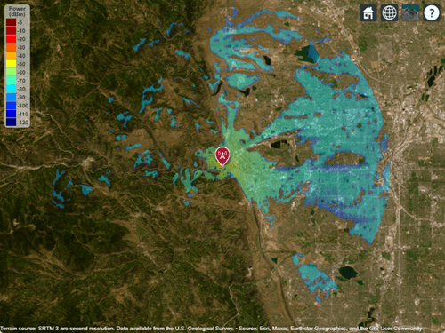
Create a coverage map of the area within 20 km of the transmitter site.
coverage(mtzion,MaxRange=20000,SignalStrengths=-100:-5)
Remove the custom terrain.
close(viewer)
removeCustomTerrain("southboulder")
Input Arguments
Name-Value Arguments
Tips
You can find and download DTED files by using EarthExplorer, a data portal provided by the US Geological Survey (USGS). From the list of data sets, search for DTED files by selecting Digital Elevation, SRTM, and then SRTM 1 Arc-Second Global and SRTM Void Filled.
Version History
Introduced in R2019b